|
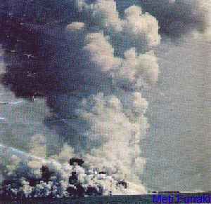
This
eruption took place in mid June 1995, in the
Ha'apai group. It is 35 miles northwest of
Ha'apai's Mo'unga'one Island, and 65 miles
southwest of Vava'u's Late Island. A dense cloud
of white smoke rose about 8,500 feet above sea
level.The island's volcanic cone has collapsed
but it still reaches more than 40m above the sea.
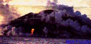
The islands of the Ha'apai group were mostly
formed by volcanoes. The highest mountain Kao,
and the highest volcano Tofua, in the Tonga
Islands, are both located in the Ha'apai
group.The Tofua volcano is dormant.
|